
 |
|
| THE MOUNT GRAPPA | |
| Access to the Mount Grappa | |
| Flora & Fauna | |
| Topographics | |
| The Big War |
|
| Montegrappa History | |
| Montain Community |
|
| Eastern Grappa | |
| FREE FLIGHT | |
| Free Flight home |
|
| Flights free para gliding |
|
| Flights free hang gliding |
|
| Aec Montegrappa | |
| Photographic Gallery | |
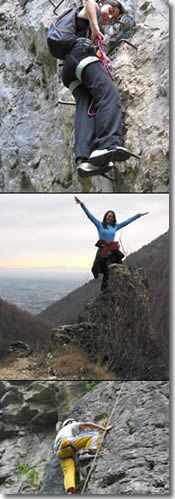
| CLIMBING | |
| Free Climbing |
|
| Arenas Indoor |
|
| Grappa Falaise |
|
| Cai Bassano of the Grappa | |
| OTHER ASSET | |
| Corlo Lake | |
| Water Earth Sky |
|
| Horse - riding |
|
| Excursions | |
| Snow Board |
|
| Activities on Brenta river |
|
| Motobike Quad |
|
| Mountain Guide |
|
| Swimmingpool |
|
| ASS. MONTEGRAPPA.ORG | |
| Who we are |
|
| How to join us |
|
| Conventional Partner |
|
| Photographic Gallery | |
| USEFUL INFORMATION | |
| Farm Holidays |
|
| Hotel & Guests house |
|
| Bed & Breakfast |
|
| Pub |
|
| Pizzerie |
|
| Camping |
|
| Restaurants |
|
| Others |
|
| Information
request |
|
| Weather Forecast | |
| Web Sponsor |
|
| Useful Links |
|
 |
HIKING PATHS OF MONTE GRAPPA The department responsable for the forests and mountain economy, using the resources of the Forest Services has developed a nature hiking path along the walking and cattle paths of the mountain, including the territories of the three provinces of Belluno, Treviso and Vicenza. The objective of the project is to create awareness amongst those who use the path of the nature surrounding the mountain, and using information panels positioned along the paths, to inform the hikers of the vegetation and fauna native to the territory. There are three principal itineraries to choose from, one for each province, and each has been developed to highlight the differing morphology of each mountain section. The sections of the hiking path, each then divided into smaller walks and connections amongst each other are: 1-The Conca of the Bocchette (Belluno section of the path); THE CONCA OF THE BOCCHETTE Departure: Refuge Bocchette di Mezzo access via Seren del Grappa (BL); Itinerary: Ca' Tasson (abieteto), Cason dei Lebi; from here, heading in direction Giarine, there are numerous paths that allow access to the Treviso hike path, taking the path that rises from the Valle dei Lebi until the Croce dei Lebi, or heading in the direction of Valpone di Fondo following two differing itineraries: that of the Valle dei Lebi or that of the Malga di Valpone. Once past the conca delle Giarine you find yourself following a crest that defines the border of the provinces of Belluno and Vicenza. Walk description: The Conca delle Bocchette: morphologically corresponds to a glacial circle (niche of glacial exhalation) modelled during the glacial period between 130,000 and 10,000 years ago. It is caracterised by various vegetation topologies determined by their micro relief forms and by the different uses in the past of the land, displayed through the presence of sediments and stone structures with relative horticultural evidence. L’abeteto: mixed forest with a prevalence of silver-fir and ref-fir, with the presence of latifoglie and faggio on hte dominant plain. The silver-fir grows well on fertile, moist land, hence on Grappa and in the Valle di Seren we can se many diverse species. Here we can also observe the falsa ortica maggiore, with its vertically displaced red flowers, and the Doronico austriaco with its large dimensions and yellow flowers. The mixed forest is one of the most receptive environments for fauna, in which we find residing Passariformi: the redbreast, the lui piccolo, the ciuffolotto, the regolo, the tordo bottaccio, the scricciolone, the cincia mora and the bigia alpestre. Among the family of predatory birds we find the sparviero and the astore. Frequently sighted are also the picchio nero, the picchio rosso and, especially in this habitat, the gallo cedrone. Cason dei Lebi: just before arriving, the cattle path runs besides a rock populated by a peculiar association: the potentilleto delle rocce, the vegetation community most widely spread on the sun-exposed, carbonatiche rocks that form the cliffs dropping to the plains of almost 200m. Of the typical species we remind you of the Bonarota comune, plant of small dimensions with an almost wooden trunk, furry and shiny leaves, and blue-violet coloured flowers, and the ranno spaccasassi the only wooden plant that lays over the sunny cliff-faces, caracterised by its intwined branches, oval shaped leaves and small green-yellow flowers that form a black fruit. In this area of the mountain, the animal community is very rich, especially with avifauna, anfibi, birds and mammals. THE PATH OF THE MEATTE Departure: the path is easily reachable from the Valle dei Lebi and the paths that arrive from Semonzo and from San Liberale; Itinerary: path of the Meatte, the Malga Archeson ot the Casone Boccaor, all arrive to the Val delle Mure, continue uphill towards the the crest which divides the provinces of Treviso and Belluno and you arrive at a brief faggetta, from here joins the section between the top of Grappa and Croce dei Lebi; Walk description: The path of the Meatte: the variety of the panorama that alternates between the small, humid, grassed canals and the dry crests has made this path a type of botantic garden that includes some of the most peculiar caracteristics on any walk on Monte Grappa, including many rare flowers. The result is a sinlge walking track populated by species that are not tied to any particular altitude. Co-exist, infact, termofile species that invade the ground exposed to the sun, and microterme species localised in cool and shadowy area where snow remains until late Spring. In particular, here lives the Campanula carnica, a vast collection of small ferns and other species that are suited to this type of terrain. Malga Archeson: a great extension of pastures created from the destruction of the forest coverage. Here develops a mosaic association of different species given the presence of the termofile species from the hills and the sub-mountain arid regions, and those typical of the colder alpine zones. The Malga, during the different seasons of the year is opoulated by various types of birdlife: such as the ballerina bianca, the culbianco, the cordirosso spazzacamino, the prispolone, the ghebbio, the buzzard, the swallow, the rondone arrives during mating season, others like the passeriformi migrate during the Autumn season. Malga delle Mure: an area where we find a caracteristic lama providing water for cattle, one of the few watering holes artificially built on the summer pasture area. The karst origin of the mountain, causing the lack of presence of water, results in the lama being populated by various types of anfibi (tritone alpino, salamandra , red frog and toad) and other forms of life specific to the lama itself. The faggetta: is the type of forest vegetation that is most present on the mountain, from 600-700m to the pastures near the top. The area around the malghe, due to the devastation caused during the war and de-forestation has caused the vegetation to diminish and allowed an infiltration of disturbing elements. Rich in birdlife and mammals, including deer, fox, beech-marten and other micromammals, attracted by the forest conversion operation being carried out by the Regional Forest Service of Treviso, who is transforming the zone from a periodically cut area into high forest. The crest between the Croce dei Lebi and Cima Grappa: refuge for the arctic-alpine species, or species stabilised here during the glacial period. In the most evident floral displays we find the;Anemone narcissiflora, the Linun alpinum, the rare Laserpitium Krapfiiand, in correspondence to the presence of Rosso Ammonitico, also noted is the typical flora of potentilleto and populations of Clematis alpina and various types of Festuca, graminacee which caracterise this grassy-rocky environment. The summit high-plain of Monte Grappa is furrowed by a network of relict valleys, where a natural karst drainage hinders the formation of waterways. The Valle delle Mure is one of the principal valleys of the high-plain and its docile morphology, formed by cycles of glacial erosion, contrasts to the "young" morphology, rocky, rain-formed cliff-faces that are still actively evolving. THE VICENZA SECTION OF THE PATH Departure: from Monte Rivon; Itinerary: from Monte Rivon follow the road until arriving to the eastern side of the Grappa summit. Walk description: Valli del Busetto and Termine: morphologically corresponds to a wide glacial cirle, of which there remains morainal embankments in a small frontal display, and a wide coverage of morainal ablations identified by frequent flowering of the calcium rocks of pig-grass. At this point begins the colonisation of the pioneering associations of stratum; on gravel and non-consolidated elements with the running of water, grows the Adenostyles glabra, a robust composition of wide toothed leaves and roseo-purpurei flowers, the Petasites paradoxus, composed of premature flowers and triangle leaves, the small omgbrellifera Athamantha cretensis, hairy and thickly branched, it prefers to live in gravel or finer rocks with velenous yellow aconite. At higher altitudes the vegetation changes with the development of pastures and various shrubs such as the lily, which plays home to a diverse range of willow and berries. Through the continual evolution of the pastures, the sun-exposed and inaccessible rock-faces have dwindled that are caracteristic of the other slopes of the mountain. The area allows you to admire birds typical of open spaces such as the allodola, the averla piccola, the rondone, the rondine and two birds of prey: the poiana and the gheppio (Falco tinnunculus), in higher altitudes it is also possibile to admire the corvo imperiale. Prepared by Citton Lisa |